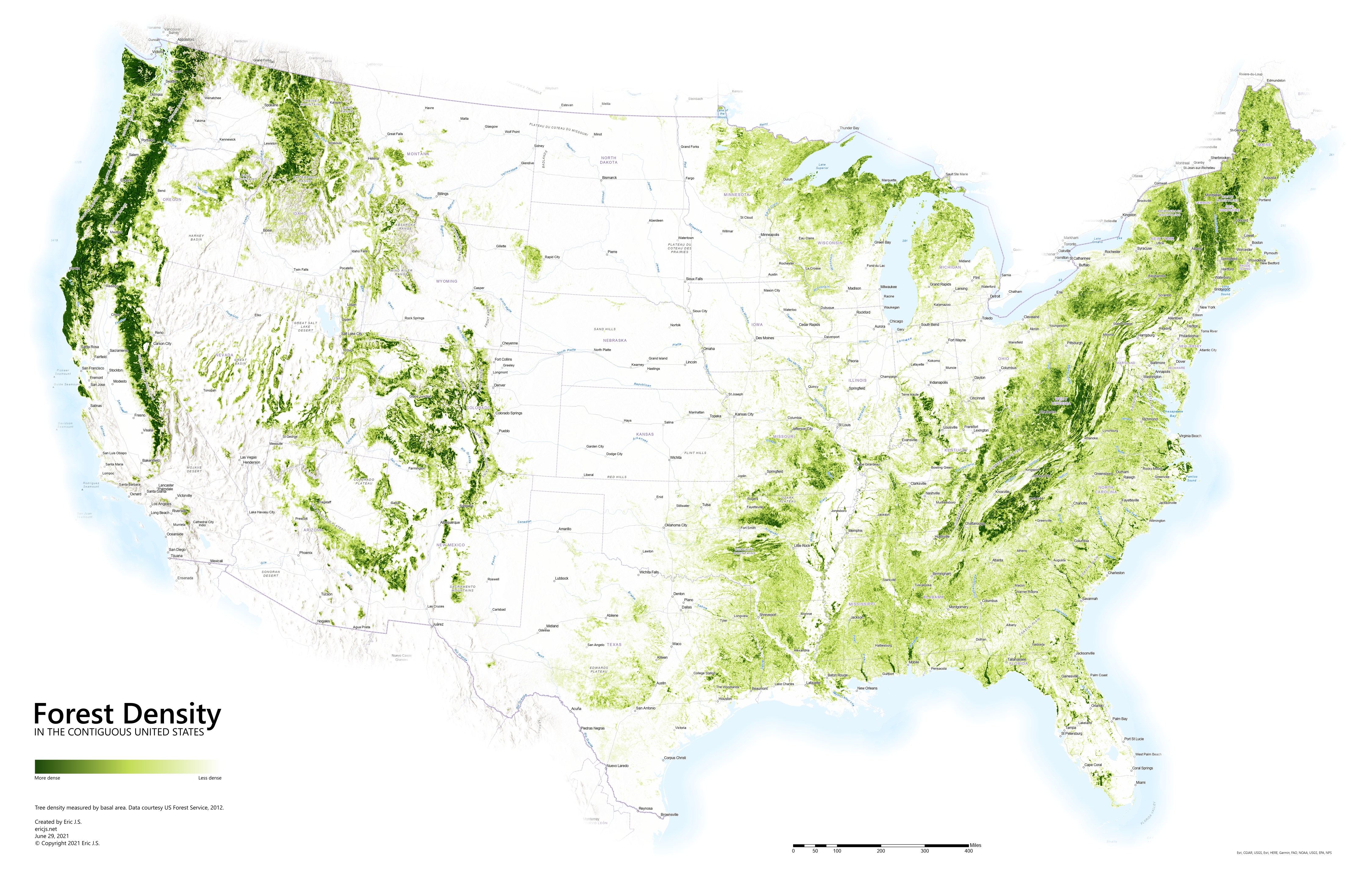
Where are the densest forests in the United States?
Created by
Eric J.S.
Posted
June 29, 2021
Last updated
June 29, 2021
Category
Analysis
Tools Used
ArcGIS ProImage Editor
Summary
Tree species vary greatly across the country and many forested areas in the United States are split by farmland or urban development. Some areas are sparse, while others are too dense to navigate. This makes some forests better suited than others for shade, sound buffering, wind protection, wildlife habitat, and privacy. So, where are the densest forests in the US?
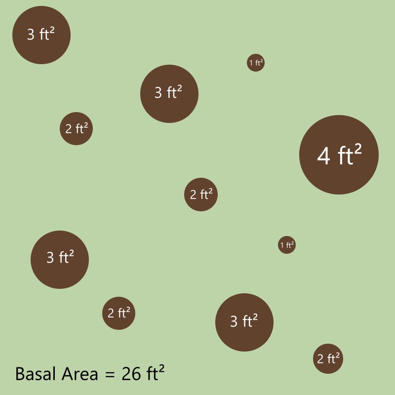
How is forest density measured?
There are a few ways of determining forest density, but I used the basal area. Basal area is the cross-sectional area of trees at breast height (1.3m or 4.5 ft above ground).
Analysis
The densest forests in the contiguous US exist in the Pacific Northwest.
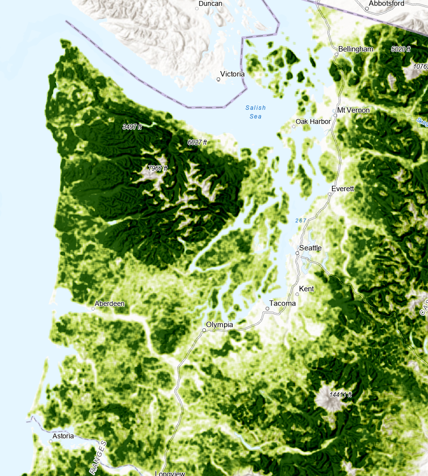 Olympic National Park and the Hoh Rain Forest certainly stand out.
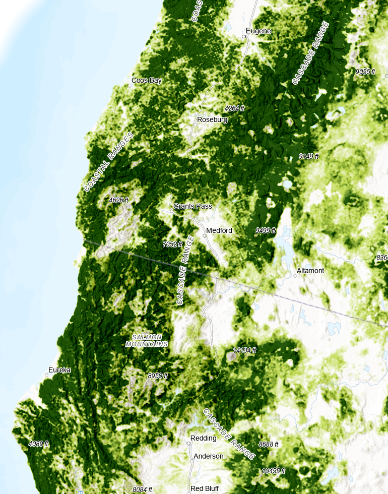 The Cascade mountain range and northern California contain some of the largest trees in the world.
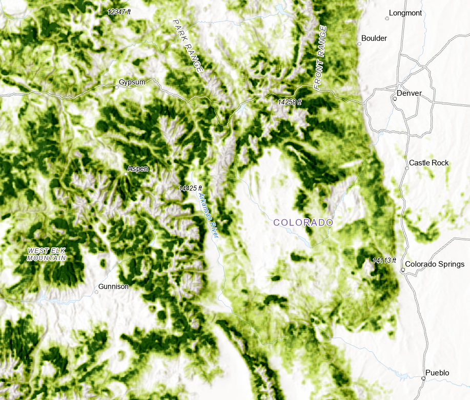 The Rocky Mountains have lush sections of forest at specific elevations.
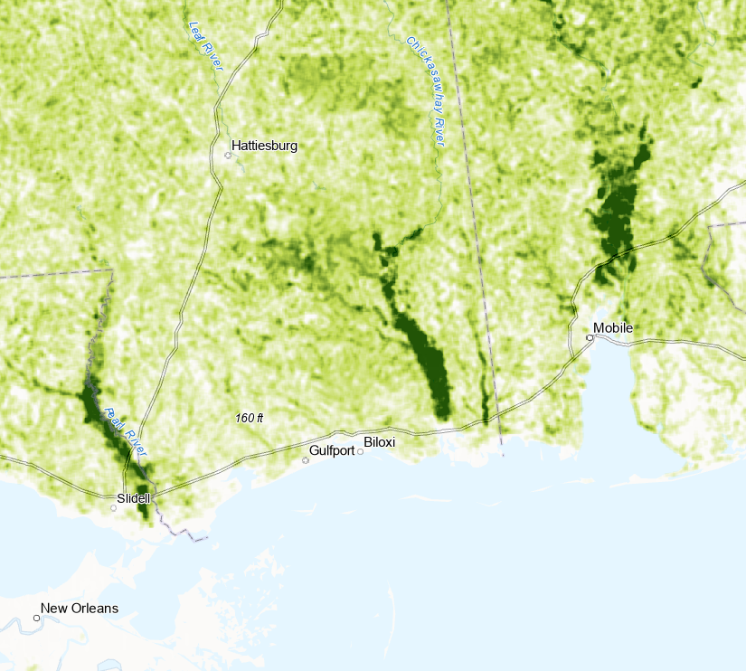 River deltas in the South produce pockets of greenery.
Introduced Error
To produce a more visually appealing map, I “blurred” the data slightly by averaging raster cells with their nearest neighbors. This was to smooth the raster data and make it less spotty.
Data Sources
The US Forest Service provides data on individual tree species and tree totals for the contiguous US. The data I used was from 2012.
https://www.fs.fed.us/foresthealth/applied-sciences/mapping-reporting/indiv-tree-parameter-maps.shtml