3D Relief: National Parks in the Canadian Rockies
Created by
Eric J.S.
Posted
September 29, 2021
Last updated
September 29, 2021
Category
Cartography
Tools Used
ArcGIS ProImage Editor
Summary
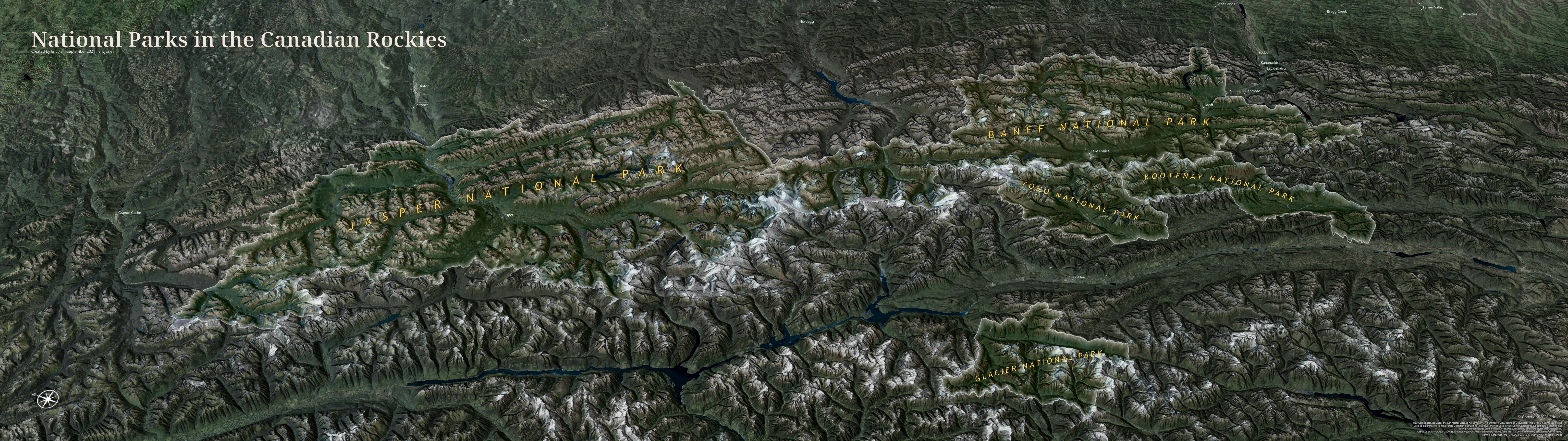
Perhaps the most gorgeous area in North America, the Canadian Rockies are protected by numerous national and provincial parks. I centered this map on the two most popular national parks, Banff and Jasper.
Process
I used a combination of hillshades, aspect, and slope raster layers all blended together to make the shadows. I also exaggerated the 3D terrain by a factor of 3 to make the topography stand out. I tried to add 3D labels in ArcGIS Pro, but due to limitations I used Inkscape to add labels instead.